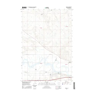
2017 Map of Nichols
USGS Topo · Published 2017About this map
The Yellowstone River winds through the heart of this Rosebud County landscape, defining the agricultural and transit patterns of the Nichols vicinity. South of the river, Old Hwy 10 and several family-named roads like Kraus Ln and Brewer Ln parallel the water, serving the farms in Howard Valley. The infrastructure of the era is marked by the Armells Creek Bridge and the Hammond Canal, which reflects the managed water usage essential for the region's ranching and farming operations.
Find a feature on this map
25 named features on this map. Tap any name to fly to it.
Don’t see what you’re looking for? This feature index may not catch every label — zoom into the map to look around manually.
Map Details
Editions of this 2017 Nichols Map
This is the sole edition of this map. No revisions or reprints were ever made.
Other maps of this area

1954 · Forsyth
USGS Topo · 1:250,000

1957 · Forsyth
USGS Topo · 1:250,000

1958 · Forsyth
USGS Topo · 1:250,000

1968 · Donleys Reservoir
USGS Topo · 1:24,000

1968 · Nichols
USGS Topo · 1:24,000

1968 · Forsyth
USGS Topo · 1:24,000

1968 · Finch NE
USGS Topo · 1:24,000

1968 · Black Coulee
USGS Topo · 1:24,000

1968 · Finch
USGS Topo · 1:24,000

1971 · Griffin Coulee NE
USGS Topo · 1:24,000