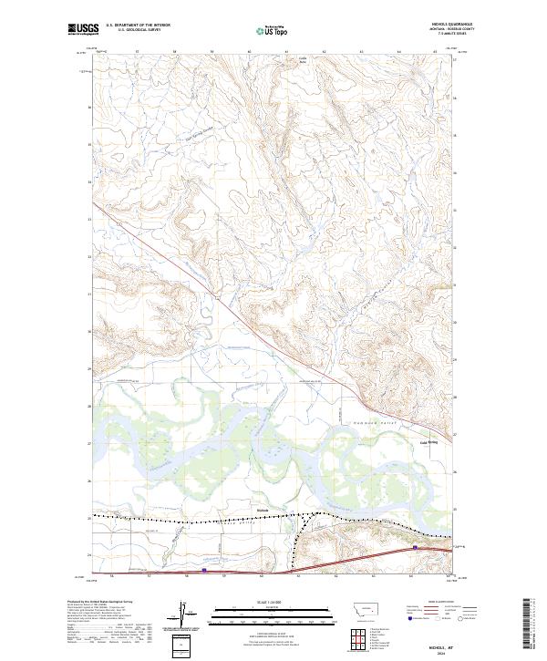
2024 Map of Nichols
USGS Topo · Published 2024About this map
Yellowstone River irrigation networks define this section of Rosebud County, where the Hammond Canal and Yellowstone Canal branch out to support the agriculture of the Hammond Valley and Howard Valley. The settlement of Nichols sits near the river's south bank, positioned between the water and the corridor of Old Hwy 10. This landscape is a mix of fertile river bottoms and the dramatic rising terrain of the northern plains, anchored by the prominent Castle Butte to the north.
Find a feature on this map
25 named features on this map. Tap any name to fly to it.
Don’t see what you’re looking for? This feature index may not catch every label — zoom into the map to look around manually.
Map Details
Editions of this 2024 Nichols Map
This is the sole edition of this map. No revisions or reprints were ever made.
Other maps of this area

1954 · Forsyth
USGS Topo · 1:250,000

1957 · Forsyth
USGS Topo · 1:250,000

1958 · Forsyth
USGS Topo · 1:250,000

1968 · Donleys Reservoir
USGS Topo · 1:24,000

1968 · Nichols
USGS Topo · 1:24,000

1968 · Forsyth
USGS Topo · 1:24,000

1968 · Finch NE
USGS Topo · 1:24,000

1968 · Black Coulee
USGS Topo · 1:24,000

1968 · Finch
USGS Topo · 1:24,000

1971 · Griffin Coulee NE
USGS Topo · 1:24,000