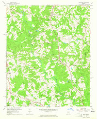
1964 Map of Nicholson
USGS Topo · Published 1965About this map
The North Oconee River winds through the heart of the Jackson County countryside in the mid-1960s, serving as a focal point for the region's rural development. Along the eastern ridge, the Southern railway connects the communities of Nicholson and Center, while the Seaboard Air Line tracks skirt the western edge through Clarksboro and Attica. This era of growth is marked by the presence of significant local landmarks such as Benton Sch and several country churches including Bethany Ch and Antioch Ch, which served as social hubs for the surrounding farmsteads.
Find a feature on this map
36 named features on this map. Tap any name to fly to it.
Don’t see what you’re looking for? This feature index may not catch every label — zoom into the map to look around manually.
Map Details
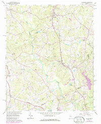
Editions of this 1964 Nicholson Map
2 editions found
Other maps of this area

1891 · Gainesville
USGS Topo · 1:125,000

1891 · Carnesville
USGS Topo · 1:125,000

1896 · Monroe
USGS Topo · 1:125,000

1953 · Athens
USGS Topo · 1:250,000

1954 · Greenville
USGS Topo · 1:250,000

1958 · Greenville
USGS Topo · 1:250,000

1958 · Athens
USGS Topo · 1:250,000

1959 · Athens
USGS Topo · 1:250,000

1963 · Athens
USGS Topo · 1:250,000

1964 · Commerce
USGS Topo · 1:24,000