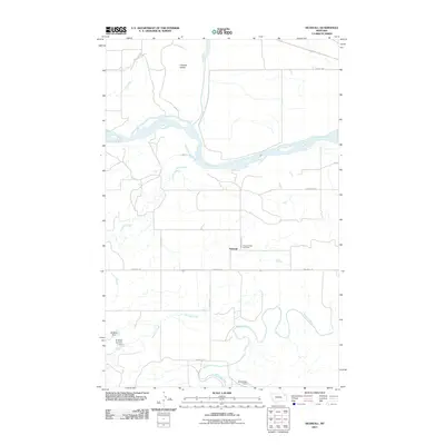
2011 Map of Nickwall
USGS Topo · Published 2011About this map
The Missouri River dominates this landscape, winding through a series of bends and creating the prominent Chelsea Island in the northern reach. This survey highlights the rural community of Nickwall, centered near Pleasant View Cemetery and the intersection of Nickwall Rd. The geography is defined by a network of seasonal and perennial waterways, including Nickwall Creek and Remley Creek, which drain toward the river systems. Several local water management features are evident, such as W Miller Dam and Shefelbine Dam, indicating the importance of water storage for ranching or agriculture in this arid region. To the south, the Redwater River snakes across the plains, joined by smaller tributaries like Chelsea Creek and Tule Creek in the northwest, illustrating the complex drainage patterns of the Missouri River basin.
Find a feature on this map
17 named features on this map. Tap any name to fly to it.
Don’t see what you’re looking for? This feature index may not catch every label — zoom into the map to look around manually.
Map Details
Editions of this 2011 Nickwall Map
This is the sole edition of this map. No revisions or reprints were ever made.
Other maps of this area

1912 · Chelsea
USGS Topo · 1:62,500

1912 · Poplar
USGS Topo · 1:62,500

1954 · Glendive
USGS Topo · 1:250,000

1954 · Wolf Point
USGS Topo · 1:250,000

1957 · Glendive
USGS Topo · 1:250,000

1958 · Wolf Point
USGS Topo · 1:250,000

1958 · Glendive
USGS Topo · 1:250,000

1972 · Chelsea SW
USGS Topo · 1:24,000

1972 · Poplar
USGS Topo · 1:24,000

1972 · Chelsea
USGS Topo · 1:24,000