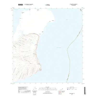
2017 Map of Niihau North
USGS Topo · Published 2017About this map
Pāni'au rises as the dominant high point above the northern landscape of Ni'ihau, where a network of deeply etched valleys defines the island's eastern coastline. This modern topographic survey illustrates the transition from the sandy expanses of Ka'aku'u Beach and Keamano Beach in the north to the dramatic cliffside terrain further south. Along the shore, numerous named points like Kaunuopou and Pūeo Point reach into the Pacific Ocean, while the interior is marked by a succession of drainages including Mōkouia Valley, Kanalo Valley, and Honua'ula Valley. This coastal orientation emphasizes the island's isolation and its reliance on natural landmarks. Settlements such as Ki'i and Pōleho are situated near the coast, reflecting the historic pattern of habitation near accessible water sources like Waiakanaio Stream and the protective geography of the Kaulakahi Channel.
Find a feature on this map
38 named features on this map. Tap any name to fly to it.
Don’t see what you’re looking for? This feature index may not catch every label — zoom into the map to look around manually.
Map Details
Editions of this 2017 Niihau North Map
This is the sole edition of this map. No revisions or reprints were ever made.
Other maps of this area

1954 · Kauai
USGS Topo · 1:250,000

1967 · Kauai
USGS Topo · 1:250,000

1970 · Kauai
USGS Topo · 1:250,000
1984 · Niihau South
USGS Topo · 1:25,000
1984 · Niihau North
USGS Topo · 1:25,000
1989 · Keanauhi Valley
USGS Topo · 1:24,000
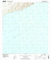
1989 · Honuaula Valley
USGS Topo · 1:24,000
2013 · Niihau North OE N
USGS Topo · 1:24,000
2013 · Niihau South
USGS Topo · 1:24,000

2013 · Niihau North OE NW
USGS Topo · 1:24,000