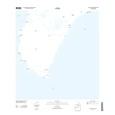
2013 Map of Niihau South
USGS Topo · Published 2013About this map
Ni‘ihau and the coastal settlement of Nonopapa anchor the southern reaches of the island as shown in this 2013 survey. The landscape is defined by its dramatic relationship with the sea, featuring a series of bays including Yam Bay and Kamalino Bay, as well as the prominent southern tip at Kawaihoa. Inward from the shore, the island's unique hydrology is visible in the form of large ephemeral basins like Halali‘i Lake and Halulu Lake, which dominate the central interior. These water bodies, along with deep-cut features such as Ki‘iala‘a Valley and Kala‘alā‘au Valley to the northeast, suggest a terrain shaped by rare but impactful water flow. This edition documents the road networks and coastal access points as they existed in the early 21st century, providing a clear record of the island's geography from Nonopapa Beach to the southern Le‘ahi Point.
Find a feature on this map
31 named features on this map. Tap any name to fly to it.
Don’t see what you’re looking for? This feature index may not catch every label — zoom into the map to look around manually.
Map Details
Editions of this 2013 Niihau South Map
This is the sole edition of this map. No revisions or reprints were ever made.
Other maps of this area

1954 · Kauai
USGS Topo · 1:250,000

1967 · Kauai
USGS Topo · 1:250,000

1970 · Kauai
USGS Topo · 1:250,000
1984 · Niihau South
USGS Topo · 1:25,000
1989 · Halalii Lake
USGS Topo · 1:24,000
1989 · Honuaula Valley
USGS Topo · 1:24,000

2013 · Niihau South OE W
USGS Topo · 1:24,000
2013 · Niihau North OE W
USGS Topo · 1:24,000
2013 · Niihau North
USGS Topo · 1:24,000
2017 · Niihau South OE W
USGS Topo · 1:24,000