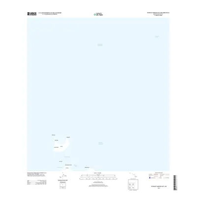
2013 Map of Niihau North OE N
USGS Topo · Published 2013About this map
The crescent-shaped islet of Lehua stands as a prominent landmark in the Pacific Ocean, separated from the northern edge of Ni'ihau by the waters of the Lehua Channel. This marine-focused survey captures the isolated coastal features of the region, where the terrain rises at Kaunuakalā and Keaulepe. On the northern coast of Ni'ihau, the shoreline is defined by modest indentations such as Ka'aku'u Bay and Keamano Bay, flanked by the distinct landforms of Kamakalepo Point and Kīkepa Point. The map illustrates a stark, maritime environment dominated by open water and narrow coastal landmasses, reflecting the remote character of this part of Kauai County.
Find a feature on this map
14 named features on this map. Tap any name to fly to it.
Don’t see what you’re looking for? This feature index may not catch every label — zoom into the map to look around manually.
Map Details
Editions of this 2013 Niihau North OE N Map
This is the sole edition of this map. No revisions or reprints were ever made.
Other maps of this area

1954 · Kauai
USGS Topo · 1:250,000

1967 · Kauai
USGS Topo · 1:250,000

1970 · Kauai
USGS Topo · 1:250,000
1984 · Niihau North
USGS Topo · 1:25,000
1989 · Keanauhi Valley
USGS Topo · 1:24,000
2013 · Niihau North OE NW
USGS Topo · 1:24,000
2013 · Niihau North OE W
USGS Topo · 1:24,000
2013 · Niihau North
USGS Topo · 1:24,000
2017 · Niihau North OE W
USGS Topo · 1:24,000
2017 · Niihau North
USGS Topo · 1:24,000