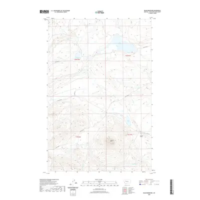
2020 Map of Nilan Reservoir
USGS Topo · Published 2020About this map
Nilan Reservoir and the surrounding high country of Lewis and Clark County define this landscape, where the plains of Central Montana meet the front range. The topography is dominated by the prominent elevation of Haystack Butte and the carved depths of Swallow Canyon to the southeast. Water management and drainage patterns are central to the area's character, with Willow Cr feeding the primary reservoir while smaller bodies like Anderson Lake and Smith Lake dot the terrain. Access through this region follows a network of primitive corridors, including Smith Creek Rd, Goss Creek Rd, and Lf Ranch Rd, which navigate the various creeks such as Ford Cr and Blubber Cr. This modern survey reflects the persistent ranching and watershed infrastructure that sustains this portion of the Montana landscape.
Find a feature on this map
20 named features on this map. Tap any name to fly to it.
Don’t see what you’re looking for? This feature index may not catch every label — zoom into the map to look around manually.
Map Details
Editions of this 2020 Nilan Reservoir Map
This is the sole edition of this map. No revisions or reprints were ever made.
Other maps of this area

1903 · Saypo
USGS Topo · 1:125,000

1903 · Coopers Lake
USGS Topo · 1:125,000

1920 · Choteau
USGS Topo · 1:125,000

1943 · Hogan
USGS Topo · 1:125,000

1955 · Choteau
USGS Topo · 1:250,000

1957 · Choteau
USGS Topo · 1:250,000

1958 · Choteau
USGS Topo · 1:250,000

1958 · Barr Creek
USGS Topo · 1:24,000

1958 · Sawtooth Ridge
USGS Topo · 1:24,000

1960 · Gilman
USGS Topo · 1:62,500