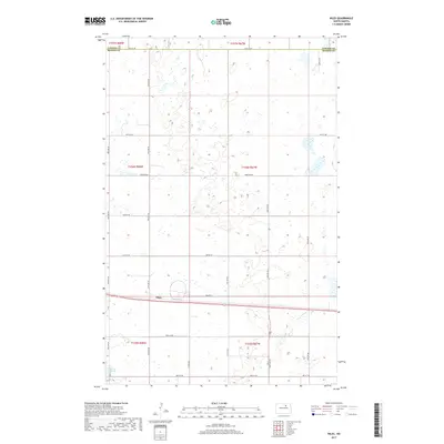
2017 Map of Niles
USGS Topo · Published 2017About this map
Niles sits along the Leeds Irvine railroad line in this 2017 study of the North Dakota prairie. The landscape is defined by the transition between Towner and Benson counties, where a dense network of sectional roads like 58th St NE and 59th Ave NE provides access to the agricultural interior. The southern edge of the map features the northern reaches of Lake Ibsen, a significant water body in an otherwise grid-dominated terrain. This survey reflects the enduring structure of the Public Land Survey System, with township boundaries such as t156n r68w and t155n r67w clearly delineated. The placement of Niles at a central transportation junction highlights its role in the local rural economy, serving the surrounding farmsteads linked by routes like Co Rd 0325.
Find a feature on this map
24 named features on this map. Tap any name to fly to it.
Don’t see what you’re looking for? This feature index may not catch every label — zoom into the map to look around manually.
Map Details
Editions of this 2017 Niles Map
This is the sole edition of this map. No revisions or reprints were ever made.
Other maps of this area

1932 · Grahams Island
USGS Topo · 1:62,500

1950 · Grahams Island
USGS Topo · 1:62,500

1951 · Tilden
USGS Topo · 1:24,000

1953 · Devils Lake
USGS Topo · 1:250,000

1956 · Devils Lake
USGS Topo · 1:250,000

1956 · Brinsmade
USGS Topo · 1:24,000

1957 · Comstock
USGS Topo · 1:24,000

1957 · Cando
USGS Topo · 1:24,000

1957 · Churchs Ferry
USGS Topo · 1:24,000
1957 · Brinsmade
USGS Topo · 1:24,000