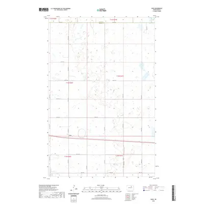
2020 Map of Niles
USGS Topo · Published 2020About this map
Niles sits at the junction of rail and road in this northern prairie landscape, situated near the boundary where Towner Co meets Benson Co. The terrain is characterized by a dense network of wetlands and small water bodies typical of the prairie pothole region, with Lake Ibsen appearing in the southwestern corner. The map documents a rigid section-line road grid, including 59th Ave NE and 66th St NE, which facilitates the region's agricultural movement. Local transit routes like Leeds Irvine and Co Rd 0325 connect the scattered farmsteads and rural townships. This survey reflects the enduring spatial organization of North Dakota's farming communities, where small settlements like Niles developed as essential transit points along the railroad.
Find a feature on this map
24 named features on this map. Tap any name to fly to it.
Don’t see what you’re looking for? This feature index may not catch every label — zoom into the map to look around manually.
Map Details
Editions of this 2020 Niles Map
This is the sole edition of this map. No revisions or reprints were ever made.
Other maps of this area

1932 · Grahams Island
USGS Topo · 1:62,500

1950 · Grahams Island
USGS Topo · 1:62,500

1951 · Tilden
USGS Topo · 1:24,000

1953 · Devils Lake
USGS Topo · 1:250,000

1956 · Devils Lake
USGS Topo · 1:250,000

1956 · Brinsmade
USGS Topo · 1:24,000

1957 · Comstock
USGS Topo · 1:24,000

1957 · Cando
USGS Topo · 1:24,000

1957 · Churchs Ferry
USGS Topo · 1:24,000
1957 · Brinsmade
USGS Topo · 1:24,000