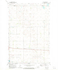
1971 Map of Niles
USGS Topo · Published 1973About this map
Lake Ibsen dominates the southern landscape of this central North Dakota survey, where the township boundaries of Normania, Lake Ibsen, Irvine, and Leeds meet. The settlement of Niles serves as a small rail point along the Burlington Northern line, which cuts east-to-west across the lower third of the quadrangle. This area of Benson County is characterized by a high density of small prairie potholes and wetlands, interspersed with numerous Gravel Pits that reflect the local glacial geology and road-building needs of the early 1970s. A lone Townhall stands in the eastern section of Irvine, marking the civic center for the surrounding agricultural community. The map also delineates the northern border with Towner County, showing the transition between these rural townships during a period of established rail transport and systematic land division.
Find a feature on this map
10 named features on this map. Tap any name to fly to it.
Don’t see what you’re looking for? This feature index may not catch every label — zoom into the map to look around manually.
Map Details
Editions of this 1971 Niles Map
This is the sole edition of this map. No revisions or reprints were ever made.
Other maps of this area

1932 · Grahams Island
USGS Topo · 1:62,500

1950 · Grahams Island
USGS Topo · 1:62,500

1951 · Tilden
USGS Topo · 1:24,000

1953 · Devils Lake
USGS Topo · 1:250,000

1956 · Devils Lake
USGS Topo · 1:250,000

1956 · Brinsmade
USGS Topo · 1:24,000

1957 · Comstock
USGS Topo · 1:24,000

1957 · Cando
USGS Topo · 1:24,000

1957 · Churchs Ferry
USGS Topo · 1:24,000
1957 · Brinsmade
USGS Topo · 1:24,000