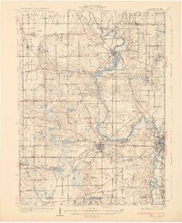
1930 Map of Niles
USGS Topo · Published 1930About this map
The St Joseph River snakes through this 1930 edition, anchoring the development of southwestern Michigan's Berrien County just before the Great Depression. At the heart of the sheet lies the established industrial and transit hub of Niles, where the Michigan Central railroad intersects with major regional thoroughfares like State Trunk Highway No 60. The landscape is densely packed with rural institutions, from the campus of Emmanuel Missionary College near Berrien Springs to a vast network of country schools such as St Joe Valley Sch and Sleepy Hollow Sch. The western portion of the quadrangle shows the drainage basins of the Galien River and Hickory Cr, supporting small farming communities like Baroda and Dayton. Genealogists will find particular value in the numerous family-named landmarks and cemeteries, including Rose Hill Cem and Hinman Cem, which dot the townships from Sodus down to the Michigan Indiana state line.
Find a feature on this map
104 named features on this map. Tap any name to fly to it.
Don’t see what you’re looking for? This feature index may not catch every label — zoom into the map to look around manually.
Map Details
Editions of this 1930 Niles Map
4 editions found
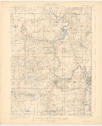
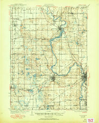
Other maps of this area

1927 · Niles
USGS Topo · 1:62,500

1927 · Hartford
USGS Topo · 1:62,500

1927 · Benton Harbor
USGS Topo · 1:62,500

1930 · Three Oaks
USGS Topo · 1:62,500

1930 · Benton Harbor
USGS Topo · 1:62,500

1930 · Niles
USGS Topo · 1:62,500

1931 · Hartford
USGS Topo · 1:62,500

1943 · Niles
USGS Topo · 1:62,500

1944 · Three Oaks
USGS Topo · 1:62,500

1945 · Cassopolis
USGS Topo · 1:62,500