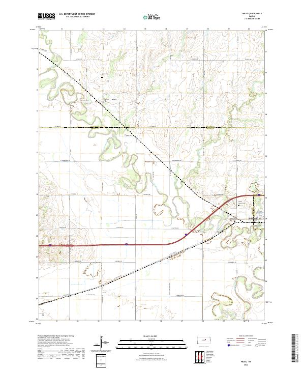
2022 Map of Niles
USGS Topo · Published 2022About this map
Niles sits within a landscape defined by the winding course of the Solomon River as it moves toward its confluence with the Smoky Hill River near the edge of Solomon. This agricultural corridor in central Kansas is marked by a grid of section-line roads like Ottawa Rd and Aspen Rd, which serve scattered farmsteads and rural landmarks. Local genealogy is anchored by the Greenville Cem and Mount Calvary Cem, providing stable points of reference for researchers tracking family histories in the area. The map illustrates the region's transport evolution, showing the transition from local gravel routes to larger thoroughfares like E Old Hwy 40, which parallels the river valleys. Smaller tributaries including Coal Cr and Buckeye Cr cut through the terrain, influencing the placement of early homesteads and modern road crossings.
Find a feature on this map
31 named features on this map. Tap any name to fly to it.
Don’t see what you’re looking for? This feature index may not catch every label — zoom into the map to look around manually.
Map Details
Editions of this 2022 Niles Map
This is the sole edition of this map. No revisions or reprints were ever made.
Other maps of this area

1889 · Abilene
USGS Topo · 1:125,000

1891 · Clay Center
USGS Topo · 1:125,000

1892 · Salina
USGS Topo · 1:125,000

1892 · Minneapolis
USGS Topo · 1:125,000

1894 · Abilene
USGS Topo · 1:125,000

1942 · Salina
USGS Topo · 1:125,000

1955 · Salina
USGS Topo · 1:24,000

1955 · Niles
USGS Topo · 1:24,000

1955 · New Cambria
USGS Topo · 1:24,000

1955 · Kipp
USGS Topo · 1:24,000