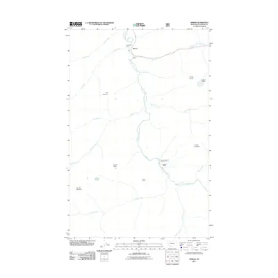
2011 Map of Nimrod
USGS Topo · Published 2011About this map
Nimrod and Java serve as small focal points along the upper reaches of the Middle Fork Flathead River, which carves a path through this mountainous section of Montana. The landscape is defined by its drainage systems, including Bear Creek and Spruce Creek, and prominent peaks like Java Mountain and Vinegar Mountain. Human presence is largely tied to forestry and transit, evidenced by the Spruce Park Forest Service Facility and the Summit Rest Area near the river. The presence of Spruce Park and the high-elevation Spruce Lookout highlights the area's role in forest management and observation. Genealogists and historians can use these records to trace the footprint of the Forest Service and the small settlements that persisted along the mountain corridors into the early 21st century. The map also captures the isolation of features like Tranquil Basin and Spruce Lake, situated far from the primary transportation route.
Find a feature on this map
27 named features on this map. Tap any name to fly to it.
Don’t see what you’re looking for? This feature index may not catch every label — zoom into the map to look around manually.
Map Details
Editions of this 2011 Nimrod Map
This is the sole edition of this map. No revisions or reprints were ever made.
Other maps of this area

1913 · Marias Pass
USGS Topo · 1:125,000

1914 · Nyack
USGS Topo · 1:125,000

1958 · Circus Peak
USGS Topo · 1:24,000

1958 · Nimrod
USGS Topo · 1:24,000

1958 · Quintonkon
USGS Topo · 1:24,000

1958 · Mount Bradley
USGS Topo · 1:24,000

1958 · Horseshoe Peak
USGS Topo · 1:24,000

1958 · Felix Peak
USGS Topo · 1:24,000

1960 · Cut Bank
USGS Topo · 1:250,000

1963 · Cut Bank
USGS Topo · 1:250,000