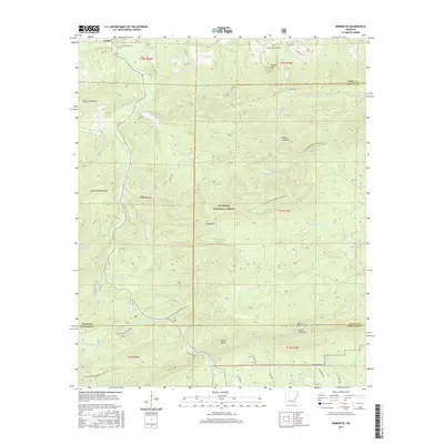
2017 Map of Nimrod SE
USGS Topo · Published 2017About this map
Goat Bluff Cem and Forked Mountain Cem sit within the high ridges and deep drainages of the Ouachita National Forest near the intersection of Perry, Saline, and Garland counties. This terrain is defined by its dramatic peaks, including Forked Mtn, White Oak Mtn, and the distinctive Smith Pinnacle. The landscape is etched by a complex hydrologic network where the Middle Fork Saline River and N Fork Ouachita River originate. The Ouachita National Recreation Trail winds through the southern half of the map, providing a continuous path across these elevations. This area shows a sparse settlement pattern dominated by forest service infrastructure like the Gladstone Forest Rd and several primitive trails such as Hollis Trl, reflecting its primarily managed wilderness character in the early 21st century.
Find a feature on this map
58 named features on this map. Tap any name to fly to it.
Don’t see what you’re looking for? This feature index may not catch every label — zoom into the map to look around manually.
Map Details
Editions of this 2017 Nimrod SE Map
This is the sole edition of this map. No revisions or reprints were ever made.
Other maps of this area

1890 · Benton
USGS Topo · 1:125,000

1890 · Hot Springs
USGS Topo · 1:125,000

1894 · Hot Springs
USGS Topo · 1:125,000

1894 · Benton
USGS Topo · 1:125,000

1955 · Little Rock
USGS Topo · 1:250,000

1956 · Little Rock
USGS Topo · 1:250,000

1960 · Little Rock
USGS Topo · 1:250,000

1963 · Paron SW
USGS Topo · 1:24,000
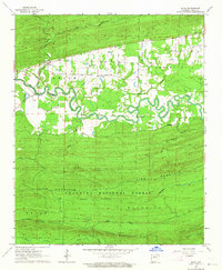
1963 · Aplin
USGS Topo · 1:24,000

1964 · Little Rock
USGS Topo · 1:250,000