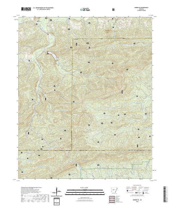
2024 Map of Nimrod SE
USGS Topo · Published 2024About this map
Flatside Wilderness and the Ouachita National Forest dominate this section of the Arkansas interior, where the boundaries of Perry, Saline, and Garland Counties converge. The landscape is defined by the significant hydrological divide between the Middle Fork Saline River and the North Fork Ouachita River. While the terrain is steep, as evidenced by prominent peaks like Forked Mtn and Smith Pinnacle, evidence of historical activity remains in the isolated Forked Mountain Cem and Goat Bluff Cem.
Find a feature on this map
63 named features on this map. Tap any name to fly to it.
Don’t see what you’re looking for? This feature index may not catch every label — zoom into the map to look around manually.
Map Details
Editions of this 2024 Nimrod SE Map
This is the sole edition of this map. No revisions or reprints were ever made.
Other maps of this area

1890 · Benton
USGS Topo · 1:125,000

1890 · Hot Springs
USGS Topo · 1:125,000

1894 · Hot Springs
USGS Topo · 1:125,000

1894 · Benton
USGS Topo · 1:125,000

1955 · Little Rock
USGS Topo · 1:250,000

1956 · Little Rock
USGS Topo · 1:250,000

1960 · Little Rock
USGS Topo · 1:250,000

1963 · Paron SW
USGS Topo · 1:24,000
1963 · Aplin
USGS Topo · 1:24,000

1964 · Little Rock
USGS Topo · 1:250,000