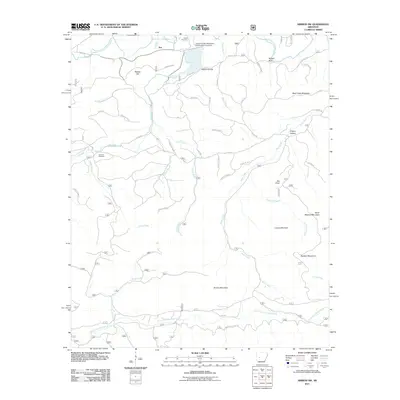
2011 Map of Nimrod SW
USGS Topo · Published 2011About this map
Ava sits at the northern edge of this landscape, positioned where the South Fourche LaFave River winds through the hills of Perry County. The terrain is defined by prominent ridges and watersheds, including Brushy Mountain, Locust Mountain, and Bear Creek Mountain, which separate the various creek systems. Historical interest is centered on several family-named landmarks and resting places, such as Hawks Cemetery near the river and Dry Fork Cemetery further south.
Find a feature on this map
49 named features on this map. Tap any name to fly to it.
Don’t see what you’re looking for? This feature index may not catch every label — zoom into the map to look around manually.
Map Details
Editions of this 2011 Nimrod SW Map
This is the sole edition of this map. No revisions or reprints were ever made.
Other maps of this area

1890 · Hot Springs
USGS Topo · 1:125,000

1894 · Hot Springs
USGS Topo · 1:125,000

1955 · Little Rock
USGS Topo · 1:250,000

1956 · Little Rock
USGS Topo · 1:250,000

1960 · Little Rock
USGS Topo · 1:250,000

1962 · Avant
USGS Topo · 1:24,000

1964 · Little Rock
USGS Topo · 1:250,000
1968 · Nimrod SE
USGS Topo · 1:24,000
1968 · Plainview
USGS Topo · 1:24,000
1968 · Nimrod
USGS Topo · 1:24,000