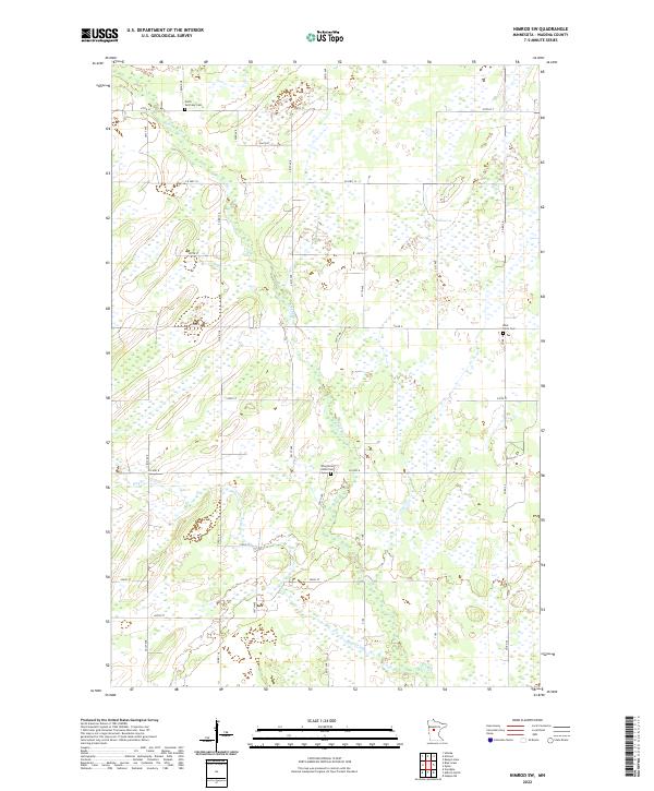
2022 Map of Nimrod SW
USGS Topo · Published 2022About this map
The Redeye River and Hay Cr wind through this corner of Wadena County, defining a landscape marked by extensive wetlands and a grid of rural roads. The area is characterized by its agricultural and natural layout, where section lines like 270th ST and 250th ST dictate the movement of travelers and residents alike. Genealogists and local historians will find value in the documentation of several rural burial sites, including North Germany Cem in the north and West Lyons Cem along the eastern boundary. The central southern portion of the quadrangle features the Wing River Union Cem, located near the junction of Co HWY 8. These landmarks, along with the meandering path of the river, provide a clear picture of the township's organization and the preservation of its community heritage.
Find a feature on this map
19 named features on this map. Tap any name to fly to it.
Don’t see what you’re looking for? This feature index may not catch every label — zoom into the map to look around manually.
Map Details
Editions of this 2022 Nimrod SW Map
This is the sole edition of this map. No revisions or reprints were ever made.
Other maps of this area

1953 · Brainerd
USGS Topo · 1:250,000

1957 · Brainerd
USGS Topo · 1:250,000

1958 · Brainerd
USGS Topo · 1:250,000

1965 · Brainerd
USGS Topo · 1:250,000

1966 · Staples NE
USGS Topo · 1:24,000

1966 · Aldrich North
USGS Topo · 1:24,000

1969 · Sebeka
USGS Topo · 1:24,000

1969 · Verndale
USGS Topo · 1:24,000
1969 · Blue Grass
USGS Topo · 1:24,000
1969 · Nimrod SW
USGS Topo · 1:24,000