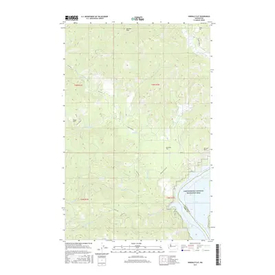
2017 Map of Ninemile Flat
USGS Topo · Published 2017About this map
Franklin D Roosevelt Lake dominates the southeastern corner of this terrain, marking the boundary between Stevens and Ferry Counties. This segment of the Lake Roosevelt National Recreation Area reveals a landscape defined by dramatic elevation changes and a dense network of watercourses. High points such as Gold Mtn Ridge and Dodge Point overlook the drainages of Ninemile Cr, Wilmont Creek, and Little Ninemile Cr. The map shows several level areas or flats that historically served as key geographic markers, including Ninemile Flat and Rima Flat. A series of Bureau of Indian Affairs roads, such as Bia RD 100 and Bia RD 1, provide the primary access through these wooded uplands and along the lakefront near Mitchell Point.
Find a feature on this map
28 named features on this map. Tap any name to fly to it.
Don’t see what you’re looking for? This feature index may not catch every label — zoom into the map to look around manually.
Map Details
Editions of this 2017 Ninemile Flat Map
This is the sole edition of this map. No revisions or reprints were ever made.
Other maps of this area

1948 · Wilbur
USGS Topo · 1:62,500

1948 · Wilmont Creek
USGS Topo · 1:62,500

1948 · Lincoln
USGS Topo · 1:62,500

1950 · Lincoln
USGS Topo · 1:62,500

1950 · Wilmont Creek
USGS Topo · 1:62,500

1950 · Wilbur
USGS Topo · 1:62,500

1952 · Keller
USGS Topo · 1:62,500

1953 · Ritzville
USGS Topo · 1:250,000

1954 · Okanogan
USGS Topo · 1:250,000

1956 · Wilmont Creek
USGS Topo · 1:62,500