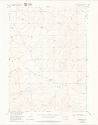
1958 Map of Ninemile Hill
USGS Topo · Published 1979About this map
Monument Butte and Ninemile Hill anchor this arid Fremont County landscape, which by the mid-20th century was defined by an extensive network of water management and resource extraction. The area is heavily marked by small reservoirs like Lander Valley Reservoir, Chugwater Reservoir, and Ninemile Reservoir, reflecting the vital importance of water storage for ranching and development in the Missouri River Basin. These human-made features are connected by natural drainages such as Sand Gulch and Ninemile Draw.
Find a feature on this map
23 named features on this map. Tap any name to fly to it.
Don’t see what you’re looking for? This feature index may not catch every label — zoom into the map to look around manually.
Map Details
Editions of this 1958 Ninemile Hill Map
2 editions found
Other maps of this area

1952 · Hudson
USGS Topo · 1:24,000

1952 · Lander SE
USGS Topo · 1:24,000

1953 · Arapahoe NE
USGS Topo · 1:24,000

1953 · Ninemile Hill
USGS Topo · 1:24,000

1953 · Bringolf Ranch
USGS Topo · 1:24,000

1953 · Arapahoe
USGS Topo · 1:24,000

1953 · Del Monte Ridge
USGS Topo · 1:24,000

1953 · Yellowstone Ranch
USGS Topo · 1:24,000

1953 · Weiser Pass
USGS Topo · 1:24,000

1955 · Lander
USGS Topo · 1:250,000