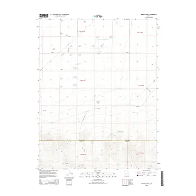
2014 Map of Ninemile Knoll
USGS Topo · Published 2014About this map
The Escalante Desert dominates this arid landscape at the boundary of Beaver and Iron counties, where the high desert floor meets the northern edges of the Black Mountains. This 2014 survey reveals a transition from the wide, relatively flat basins of the north to the increasingly complex topography of the south, characterized by features like Black Canyon and the prominent volcanic profile of Ninemile Knoll. Hydrological patterns are typical of the Great Basin, with seasonal or interior drainage points such as The Sink and a series of livestock-supporting waters including Cactus Pond, Mound Pond, and Willow Spring. The human imprint on this desert terrain is defined by a sparse grid of range roads, including the descriptive Pig Farm Rd and Thermo Rd, alongside the winding Horse Valley Wash Rd that follows the natural drainage towards the southern highlands.
Find a feature on this map
25 named features on this map. Tap any name to fly to it.
Don’t see what you’re looking for? This feature index may not catch every label — zoom into the map to look around manually.
Map Details
Editions of this 2014 Ninemile Knoll Map
This is the sole edition of this map. No revisions or reprints were ever made.
Other maps of this area

1885 · Beaver
USGS Topo · 1:250,000

1953 · Ninemile Knoll
USGS Topo · 1:24,000

1953 · Milford Flat
USGS Topo · 1:24,000

1953 · Minersville
USGS Topo · 1:24,000

1953 · Cave Canyon
USGS Topo · 1:24,000

1953 · Richfield
USGS Topo · 1:250,000

1958 · Richfield
USGS Topo · 1:250,000

1958 · Minersville
USGS Topo · 1:62,500

1958 · Thermo
USGS Topo · 1:62,500

1958 · Milford
USGS Topo · 1:62,500