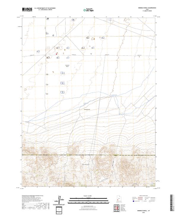
2023 Map of Ninemile Knoll
USGS Topo · Published 2023About this map
Escalante Desert floor and the rising slopes of the Black Mountains meet in this southwestern Utah landscape along the border of Beaver Co and Iron Co. The map documents a transition from the broad, arid flats of the desert toward the more complex topography of the foothills. Sparse water sources are the defining features of this environment, including Cactus Pond, Mound Pond, and Sand Pond, which sit at the base of the drainage systems. Human infrastructure is limited to travel corridors like Thermal Rd and the S Spur of East Fork Rd. The central landmark, Ninemile Knoll, rises from the desert floor, while the southern portion of the sheet is dominated by deep cuts such as Black Canyon and Little Black Canyon, indicating the drainage patterns that feed into The Sink and isolated water points like Dry Willow Spring.
Find a feature on this map
14 named features on this map. Tap any name to fly to it.
Don’t see what you’re looking for? This feature index may not catch every label — zoom into the map to look around manually.
Map Details
Editions of this 2023 Ninemile Knoll Map
This is the sole edition of this map. No revisions or reprints were ever made.
Other maps of this area

1885 · Beaver
USGS Topo · 1:250,000

1953 · Ninemile Knoll
USGS Topo · 1:24,000

1953 · Milford Flat
USGS Topo · 1:24,000

1953 · Minersville
USGS Topo · 1:24,000

1953 · Cave Canyon
USGS Topo · 1:24,000

1953 · Richfield
USGS Topo · 1:250,000

1958 · Richfield
USGS Topo · 1:250,000

1958 · Minersville
USGS Topo · 1:62,500

1958 · Thermo
USGS Topo · 1:62,500

1958 · Milford
USGS Topo · 1:62,500