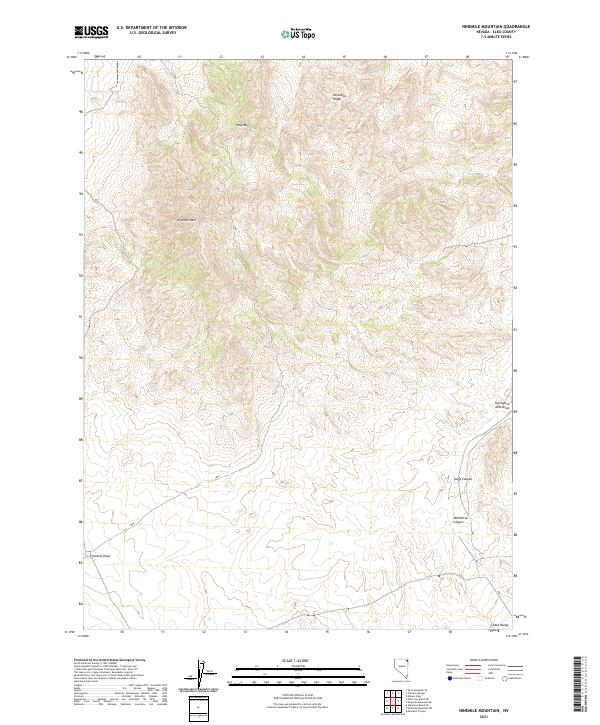
2021 Map of Ninemile Mountain
USGS Topo · Published 2021About this map
Ninemile Mtn and the surrounding high desert terrain dominate this northeastern Nevada landscape within Elko County. The map documents a rugged section of the Great Basin characterized by significant relief, featuring the Ninemile Ridge to the north and the northern edge of the Leach Range at the southern boundary. Steep canyons and seasonal drainage systems, including Wildhorse Canyon and Kane Canyon, define the local topography, indicating a landscape shaped by intermittent water flow. The naming convention of local landmarks suggests early distance-marking by travelers or ranchers, as seen in both Fivemile Draw and Twentyone Mile Draw. This modern U.S. Geological Survey survey illustrates the enduring wilderness character of the region, where topographical prominent points like Tony Mtn serve as the primary navigation markers in an area largely devoid of permanent settlements or infrastructure.
Find a feature on this map
14 named features on this map. Tap any name to fly to it.
Don’t see what you’re looking for? This feature index may not catch every label — zoom into the map to look around manually.
Map Details
Editions of this 2021 Ninemile Mountain Map
This is the sole edition of this map. No revisions or reprints were ever made.
Other maps of this area

1955 · Wells
USGS Topo · 1:250,000

1958 · Wells
USGS Topo · 1:250,000

1961 · Wells
USGS Topo · 1:250,000

1961 · Delano Mountains
USGS Topo · 1:62,500

1967 · Montello Canyon
USGS Topo · 1:24,000

1967 · Ninemile Mtn NE
USGS Topo · 1:24,000

1967 · Ninemile Mtn SW
USGS Topo · 1:24,000

1967 · Ninemile Mtn
USGS Topo · 1:24,000

1968 · Knoll Mountain SE
USGS Topo · 1:24,000

1968 · Wine Cup Ranch SE
USGS Topo · 1:24,000