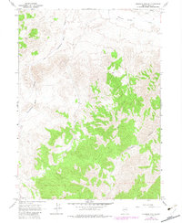
1967 Map of Ninemile Mtn NE
USGS Topo · Published 1982About this map
Thousand Springs Creek flows through the northern reaches of this Elko County landscape, a region defined by its high-desert drainage patterns and dramatic topographic relief. The terrain is deeply incised by natural corridors such as Twentymone Draw and the steep-walled Twelvemile Canyon, which underscore the isolation and hydraulic character of the Nevada interior. This 1967 survey, updated with 1980 aerial photogrammetry, reveals a land almost entirely devoid of permanent settlement, with human presence marked only by a few Wells, a scattered Spring, and high-clearance 4wd tracks. The placement of these water sources was critical for the ranching and resource extraction activities that have historically shaped this part of the Great Basin.
Find a feature on this map
8 named features on this map. Tap any name to fly to it.
Don’t see what you’re looking for? This feature index may not catch every label — zoom into the map to look around manually.
Map Details
Editions of this 1967 Ninemile Mtn NE Map
2 editions found
Other maps of this area

1955 · Wells
USGS Topo · 1:250,000

1958 · Wells
USGS Topo · 1:250,000

1961 · Wells
USGS Topo · 1:250,000

1961 · Delano Mountains
USGS Topo · 1:62,500

1961 · Dairy Valley
USGS Topo · 1:62,500

1967 · Montello Canyon
USGS Topo · 1:24,000

1967 · Twelvemile Ranch
USGS Topo · 1:24,000

1967 · Montello
USGS Topo · 1:24,000

1967 · Ninemile Mtn NE
USGS Topo · 1:24,000

1967 · Ninemile Mtn SW
USGS Topo · 1:24,000