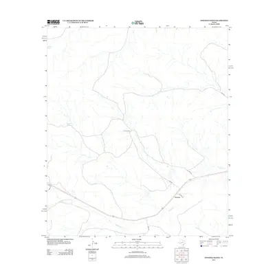
2012 Map of Ninemile Ranch
USGS Topo · Published 2012About this map
Ninemile Ranch and the small settlement of Emerson anchor this portion of Terrell County, where the landscape is defined by a network of seasonal watercourses and ranch access roads. The drainage of Sanderson Cr and Dry Cr dictates the local topography, carving paths through the West Texas brush country. Water management is a primary feature of the region, as evidenced by the presence of livestock watering holes such as Fortyone Tank and Jackson Tank. Transportation in the early 21st century remains centered on a combination of established routes like Longfellow Rd and Gregory Rd, alongside numeric designations such as 6 Mile Rd and 8 Mile Rd. These roads connect isolated ranching outposts and follow the natural contours of the terrain, illustrating the enduring relationship between large-scale land holdings and the geography of the Trans-Pecos.
Find a feature on this map
11 named features on this map. Tap any name to fly to it.
Don’t see what you’re looking for? This feature index may not catch every label — zoom into the map to look around manually.
Map Details
Editions of this 2012 Ninemile Ranch Map
This is the sole edition of this map. No revisions or reprints were ever made.
Other maps of this area

1920 · Longfellow
USGS Topo · 1:125,000

1928 · Sanderson
USGS Topo · 1:125,000

1954 · Fort Stockton
USGS Topo · 1:250,000

1958 · Fort Stockton
USGS Topo · 1:250,000

1968 · Big Brindle Canyon
USGS Topo · 1:24,000

1968 · Toms Canyon
USGS Topo · 1:24,000

1968 · F C Ranch
USGS Topo · 1:24,000

1968 · Fresno Creek
USGS Topo · 1:24,000

1968 · Longfellow
USGS Topo · 1:24,000

1968 · Ninemile Ranch
USGS Topo · 1:24,000