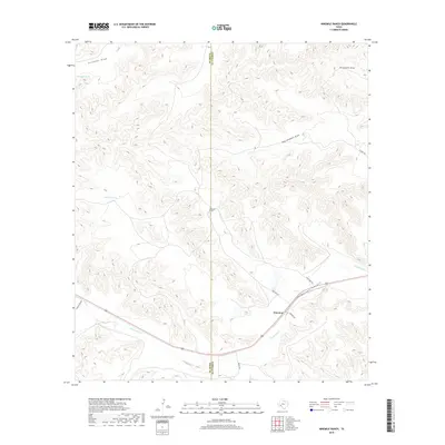
2019 Map of Ninemile Ranch
USGS Topo · Published 2019About this map
The settlement of Emerson and the nearby Ninemile Ranch anchor this landscape along the border of Pecos and Terrell Counties. The terrain is defined by a complex network of dry watercourses, most notably Sanderson Canyon and the winding Sanderson Cr. Strategic water management is evident through labeled features like Fortyone Tank and Jackson Tank, which provide essential resources in this arid environment. Transportation through the area follows the natural topography, with Nine Mile Rd and Eight Mile Rd connecting the scattered ranching interests. This map highlights the rural infrastructure of West Texas, where drainage patterns like Red Windmill Draw and Threemile Draw dictate the placement of roads and homesteads.
Find a feature on this map
17 named features on this map. Tap any name to fly to it.
Don’t see what you’re looking for? This feature index may not catch every label — zoom into the map to look around manually.
Map Details
Editions of this 2019 Ninemile Ranch Map
This is the sole edition of this map. No revisions or reprints were ever made.
Other maps of this area

1920 · Longfellow
USGS Topo · 1:125,000

1928 · Sanderson
USGS Topo · 1:125,000

1954 · Fort Stockton
USGS Topo · 1:250,000

1958 · Fort Stockton
USGS Topo · 1:250,000

1968 · Big Brindle Canyon
USGS Topo · 1:24,000

1968 · Toms Canyon
USGS Topo · 1:24,000

1968 · F C Ranch
USGS Topo · 1:24,000

1968 · Fresno Creek
USGS Topo · 1:24,000

1968 · Longfellow
USGS Topo · 1:24,000

1968 · Ninemile Ranch
USGS Topo · 1:24,000