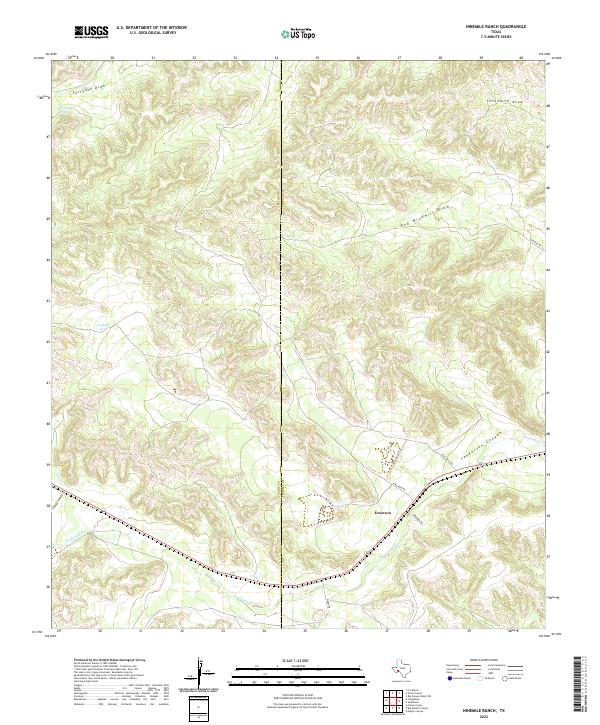
2022 Map of Ninemile Ranch
USGS Topo · Published 2022About this map
The settlement of Emerson serves as a lonely landmark in this high desert landscape of West Texas, situated along the shared boundary between Pecos and Terrell counties. The terrain is defined by a dense network of intermittent watercourses, where ephemeral drainage systems like Sanderson Cr and Dry Cr carve intricate patterns through the limestone plateaus. Life in this arid environment revolves around vital water collection points such as Jackson Tank and Fortyone Tank, which provide necessary resources for ranching operations in a region dominated by deep draws and canyons.
Find a feature on this map
15 named features on this map. Tap any name to fly to it.
Don’t see what you’re looking for? This feature index may not catch every label — zoom into the map to look around manually.
Map Details
Editions of this 2022 Ninemile Ranch Map
This is the sole edition of this map. No revisions or reprints were ever made.
Other maps of this area

1920 · Longfellow
USGS Topo · 1:125,000

1928 · Sanderson
USGS Topo · 1:125,000

1954 · Fort Stockton
USGS Topo · 1:250,000

1958 · Fort Stockton
USGS Topo · 1:250,000

1968 · Big Brindle Canyon
USGS Topo · 1:24,000

1968 · Toms Canyon
USGS Topo · 1:24,000

1968 · F C Ranch
USGS Topo · 1:24,000

1968 · Fresno Creek
USGS Topo · 1:24,000

1968 · Longfellow
USGS Topo · 1:24,000

1968 · Ninemile Ranch
USGS Topo · 1:24,000