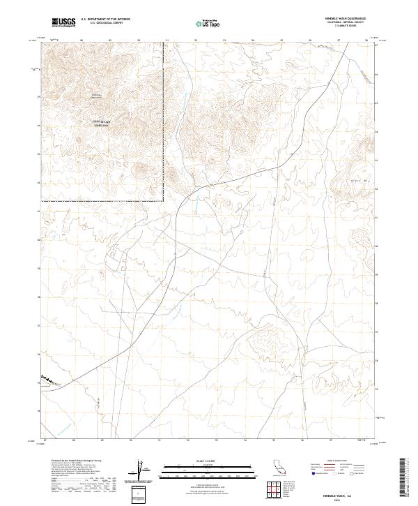
2021 Map of Ninemile Wash
USGS Topo · Published 2021About this map
Chocolate Mountains and Black Mtn dominate the topography of this Imperial County desert landscape, where seasonal drainage is defined by the extensive reach of Ninemile Wash. The map documents a rugged interior characterized by vast open spaces and limited vehicular access, with specialized routes like Vista Mine Rd and Geoc-Mine Rd hinting at the area's geological and extractive interests. The arid terrain is navigated via a sparse network of roads including Imperial Gables Rd and Co Hwy S34, which connect the remote foothills to the broader California desert. This 2021 survey provides a contemporary record of land use and surveying boundaries, specifically noted by the Township and Range lines of t12s r19e and t13s r19e, illustrating how the desert floor is organized for modern land management and public access.
Find a feature on this map
12 named features on this map. Tap any name to fly to it.
Don’t see what you’re looking for? This feature index may not catch every label — zoom into the map to look around manually.
Map Details
Editions of this 2021 Ninemile Wash Map
This is the sole edition of this map. No revisions or reprints were ever made.
Other maps of this area

1903 · Yuma
USGS Topo · 1:125,000

1905 · Yuma
USGS Topo · 1:125,000

1907 · Holtville
USGS Topo · 1:125,000

1942 · El Centro
USGS Topo · 1:250,000

1942 · Yuma
USGS Topo · 1:250,000

1942 · Blythe
USGS Topo · 1:250,000

1953 · Quartz Peak
USGS Topo · 1:62,500

1953 · Ogilby
USGS Topo · 1:62,500

1953 · Acolita
USGS Topo · 1:62,500

1954 · El Centro
USGS Topo · 1:250,000