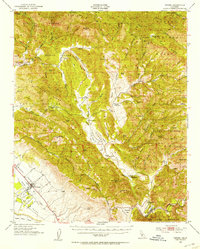
1952 Map of Nipomo
USGS Topo · Published 1953About this map
Huasna Valley and the surrounding coastal ranges of the Los Padres National Forest define this 1952 study. The landscape is characterized by a network of private holdings and early infrastructure, including numerous family-named landmarks such as Porter Ranch, Tar Spring Ranch, and Records Ranch. The map reveals the early industrial footprint of the region, featuring several Oil Wells (Aban'd) and the Iron Door Mine tucked into the canyons. Local education and community hubs are marked by the Santa Manuela School and Huasna School, while the presence of a Charcoal Kiln near the Arroyo Grande Creek suggests traditional resource extraction. In the southwest, the transition from the rugged ridges to the Nipomo Mesa and Santa Maria Valley marks the beginning of the more settled agricultural coastal plain.
Find a feature on this map
78 named features on this map. Tap any name to fly to it.
Don’t see what you’re looking for? This feature index may not catch every label — zoom into the map to look around manually.
Map Details
Editions of this 1952 Nipomo Map
3 editions found
Other maps of this area

1897 · San Luis Obispo
USGS Topo · 1:62,500

1897 · Arroyo Grande
USGS Topo · 1:62,500

1900 · San Luis
USGS Topo · 1:125,000

1905 · Guadalupe
USGS Topo · 1:125,000

1905 · Lompoc
USGS Topo · 1:125,000

1922 · Pozo
USGS Topo · 1:62,500

1922 · Nipomo
USGS Topo · 1:62,500

1932 · La Panza
USGS Topo · 1:48,000

1935 · La Panza
USGS Topo · 1:62,500

1936 · La Panza
USGS Topo · 1:62,500