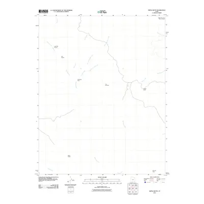
2011 Map of Nipple Butte
USGS Topo · Published 2011About this map
Nipple Butte rises as a prominent landmark in this desert landscape of southern Utah, defining a region characterized by deep drainages and named geological transitions. The drainage network is complex, featuring Wahweap Creek and its many tributaries such as Ty Hatch Creek and Smith Run, which have carved out features like Pet Hollow and Long Flat Canyon. The presence of Nipple Spring suggests a critical water source in an otherwise arid environment, while named passages like Tworoose Pass indicate the historical routes used to navigate this broken terrain.
Find a feature on this map
19 named features on this map. Tap any name to fly to it.
Don’t see what you’re looking for? This feature index may not catch every label — zoom into the map to look around manually.
Map Details
Editions of this 2011 Nipple Butte Map
This is the sole edition of this map. No revisions or reprints were ever made.
Other maps of this area

1886 · Escalante
USGS Topo · 1:250,000

1922 · Upper Last Chance
USGS Topo · 1:63,360

1953 · Nipple Butte
USGS Topo · 1:62,500

1954 · Paria
USGS Topo · 1:62,500

1956 · Escalante
USGS Topo · 1:250,000

1960 · Escalante
USGS Topo · 1:250,000

1964 · Horse Flat
USGS Topo · 1:24,000

1968 · Fourmile Bench
USGS Topo · 1:24,000
1968 · Ship Mountain Point
USGS Topo · 1:24,000
1981 · Tibbet Bench
USGS Topo · 1:24,000