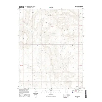
2017 Map of Nipple Butte
USGS Topo · Published 2017About this map
The high desert landscape of Kane County is defined by a series of prominent elevated plateaus and drainage systems. Named benches are a dominant topographic characteristic, with several likely linked to early ranching or exploration history, including Jack Riggs Bench, John Wills Bench, and Snow Bench. These flat-topped features are separated by a complex network of canyons and washes, such as Long Flat Canyon and Clints Canyon, which direct seasonal runoff toward Wahweap Creek.
Find a feature on this map
31 named features on this map. Tap any name to fly to it.
Don’t see what you’re looking for? This feature index may not catch every label — zoom into the map to look around manually.
Map Details
Editions of this 2017 Nipple Butte Map
This is the sole edition of this map. No revisions or reprints were ever made.
Other maps of this area

1886 · Escalante
USGS Topo · 1:250,000

1922 · Upper Last Chance
USGS Topo · 1:63,360

1953 · Nipple Butte
USGS Topo · 1:62,500

1954 · Paria
USGS Topo · 1:62,500

1956 · Escalante
USGS Topo · 1:250,000

1960 · Escalante
USGS Topo · 1:250,000

1964 · Horse Flat
USGS Topo · 1:24,000

1968 · Fourmile Bench
USGS Topo · 1:24,000
1968 · Ship Mountain Point
USGS Topo · 1:24,000
1981 · Tibbet Bench
USGS Topo · 1:24,000