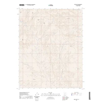
2023 Map of Nipple Butte
USGS Topo · Published 2023About this map
Nipple Butte rises as a prominent landmark in this desert landscape of southern Utah, serving as a focal point for a complex network of dry canyons and named plateaus. The terrain is characterized by a series of distinct benches, many carrying family names such as John Wills Bench, Jack Riggs Bench, Ty Hatch Bench, and Sit Down Bench, which speak to the historic ranching and land-use patterns of Kane County.
Find a feature on this map
24 named features on this map. Tap any name to fly to it.
Don’t see what you’re looking for? This feature index may not catch every label — zoom into the map to look around manually.
Map Details
Editions of this 2023 Nipple Butte Map
This is the sole edition of this map. No revisions or reprints were ever made.
Other maps of this area

1886 · Escalante
USGS Topo · 1:250,000

1922 · Upper Last Chance
USGS Topo · 1:63,360

1953 · Nipple Butte
USGS Topo · 1:62,500

1954 · Paria
USGS Topo · 1:62,500

1956 · Escalante
USGS Topo · 1:250,000

1960 · Escalante
USGS Topo · 1:250,000

1964 · Horse Flat
USGS Topo · 1:24,000

1968 · Fourmile Bench
USGS Topo · 1:24,000
1968 · Ship Mountain Point
USGS Topo · 1:24,000
1981 · Tibbet Bench
USGS Topo · 1:24,000