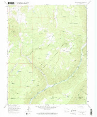
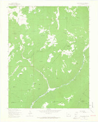
1963 Map of Nipple Mountain
USGS Topo · Published 1972About this map
West Dolores River carves a deep valley through the high country of the San Juan National Forest, serving as the primary corridor for movement and recreation in this part of Colorado. The 1963 survey captures a landscape defined by water management and forest service infrastructure, dotted with numerous small-scale irrigation and stock water sources like Zwicker Reservoir and Drift Fence Reservoir. The presence of the Cottonwood Guard Station and established sites like Mavreeso Campground and Emerson Campground reflects the mid-century development of public land management and outdoor access. Elevated terrain such as Nipple Mountain and Stoner Mesa provide the dramatic verticality of the region, while a network of jeep and pack trails connects remote points like Pease Point and the family-named King Ranch Spring.
Find a feature on this map
50 named features on this map. Tap any name to fly to it.
Don’t see what you’re looking for? This feature index may not catch every label — zoom into the map to look around manually.
Map Details
Editions of this 1963 Nipple Mountain Map
4 editions found
Other maps of this area

1897 · Rico
USGS Topo · 1:62,500

1898 · Rico
USGS Topo · 1:62,500

1899 · Rico
USGS Topo · 1:62,500

1956 · Cortez
USGS Topo · 1:250,000

1958 · Cortez
USGS Topo · 1:250,000

1959 · Cortez
USGS Topo · 1:250,000

1962 · Cortez
USGS Topo · 1:250,000

1963 · Stoner
USGS Topo · 1:24,000
1963 · Wallace Ranch
USGS Topo · 1:24,000
1963 · Nipple Mountain
USGS Topo · 1:24,000