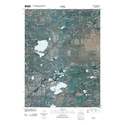
2010 Map of Niwot
USGS Topo · Published 2010About this map
Left Hand Creek and Boulder Creek cut through this landscape northeast of Boulder, defining a region where water management is central to the local geography. A complex network of irrigation infrastructure including the Boulder and Left Hand Ditch, Boulder Feeder Canal, and Star Ditch connects numerous storage sites such as Boulder Reservoir, Dodd Reservoir, and Sixmile Reservoir. This system supports both agricultural heritage and modern development, with older mining and industrial sites like the New Girl Mine and Colorado Brick Pit situated near established settlements like Niwot and Valmont. The presence of the Boulder Municipal Airport and the United States Postal Service Annex reflects the area's role as a regional hub. Local history is anchored by family and community landmarks, including Niwot Cemetery and prominent topographic features like Haystack Mountain and Gun Barrel Hill.
Find a feature on this map
95 named features on this map. Tap any name to fly to it.
Don’t see what you’re looking for? This feature index may not catch every label — zoom into the map to look around manually.
Map Details
Editions of this 2010 Niwot Map
This is the sole edition of this map. No revisions or reprints were ever made.
Other maps of this area

1899 · West Denver
USGS Topo · 1:125,000

1902 · Boulder
USGS Topo · 1:62,500

1904 · Niwot
USGS Topo · 1:62,500

1904 · Boulder
USGS Topo · 1:62,500

1906 · Blackhawk
USGS Topo · 1:62,500

1940 · Lafayette
USGS Topo · 1:31,680

1942 · Eldorado Springs
USGS Topo · 1:24,000

1942 · Louisville
USGS Topo · 1:31,680

1944 · Lafayette
USGS Topo · 1:31,680

1944 · Eldorado Springs
USGS Topo · 1:31,680