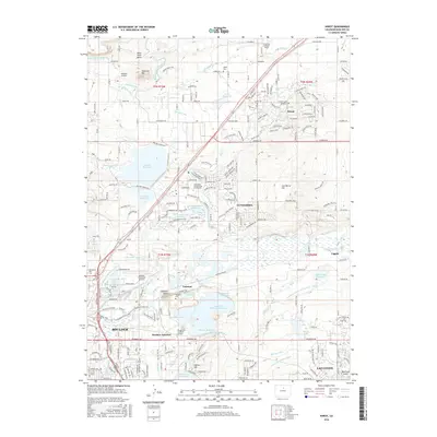
2016 Map of Niwot
USGS Topo · Published 2016About this map
Haystack Mtn and Gun Barrel Hill anchor this map of the corridor between Boulder and Lafayette, illustrating a landscape defined by an intricate network of irrigation and water storage. The heavy density of man-made waterways, including the Boulder and Whiterock Ditch and the Holland Left Hand Ditch, highlights the region's historical reliance on managed water for agriculture and municipal development. Local industry and institutional growth are visible through the large IBM Plant and the Naropa Univ Nalanda Campus. The map also preserves traces of the area's older history through the Niwot Cem and Valmont Cem, while highlighting modern transitions with the presence of the Boulder Municipal Airport and Ashlawn Airport.
Find a feature on this map
89 named features on this map. Tap any name to fly to it.
Don’t see what you’re looking for? This feature index may not catch every label — zoom into the map to look around manually.
Map Details
Editions of this 2016 Niwot Map
This is the sole edition of this map. No revisions or reprints were ever made.
Other maps of this area

1899 · West Denver
USGS Topo · 1:125,000

1902 · Boulder
USGS Topo · 1:62,500

1904 · Niwot
USGS Topo · 1:62,500

1904 · Boulder
USGS Topo · 1:62,500

1906 · Blackhawk
USGS Topo · 1:62,500

1940 · Lafayette
USGS Topo · 1:31,680

1942 · Eldorado Springs
USGS Topo · 1:24,000

1942 · Louisville
USGS Topo · 1:31,680

1944 · Lafayette
USGS Topo · 1:31,680

1944 · Eldorado Springs
USGS Topo · 1:31,680