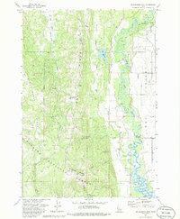
1973 Map of No Business Mountain
USGS Topo · Published 1986About this map
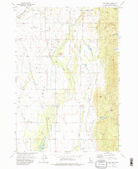
Long Valley serves as a stark topographical divide in this Idaho survey, where the meandering North Fork Payette River cuts through the lowlands while the high timber of the Payette National Forest dominates the west. The landscape is a study in early 1970s resource management and transportation, featuring the operational Union Pacific line running parallel to an abandoned Old Railroad Grade near the northern boundary.
Find a feature on this map
30 named features on this map. Tap any name to fly to it.
Don’t see what you’re looking for? This feature index may not catch every label — zoom into the map to look around manually.
Map Details
Editions of this 1973 No Business Mountain Map
2 editions found
Other maps of this area

1911 · Meadows
USGS Topo · 1:125,000

1954 · Council
USGS Topo · 1:62,500

1954 · New Meadows
USGS Topo · 1:62,500

1954 · Cascade
USGS Topo · 1:62,500

1955 · Baker
USGS Topo · 1:250,000

1959 · Baker
USGS Topo · 1:250,000
1973 · Meadows
USGS Topo · 1:24,000
1973 · No Business Mtn
USGS Topo · 1:24,000
1973 · McCall
USGS Topo · 1:24,000
1973 · Lake Fork
USGS Topo · 1:24,000