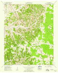
1956 Map of Noah
USGS Topo · Published 1958About this map
The Dixie Highway West (U.S. 41) cuts a straight path through the center of this 1956 landscape, connecting the clustered settlements of Beech Grove and Noah. The terrain is defined by a dense network of hollows, such as Crosslin Hollow and Huffman Hollow, which feed into the Noah Fork and Hurricane Creek. These deep incisions in the land dictate the placement of small rural communities and family landmarks, from Gnat Hill in the northeast to the waters of Bedford Lake at the southern boundary.
Find a feature on this map
66 named features on this map. Tap any name to fly to it.
Don’t see what you’re looking for? This feature index may not catch every label — zoom into the map to look around manually.
Map Details
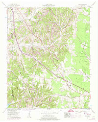
Editions of this 1956 Noah Map
2 editions found
Other maps of this area

1913 · Hollow Springs
USGS Topo · 1:62,500

1936 · Ovoca
USGS Topo · 1:24,000

1936 · Webbs Jungle
USGS Topo · 1:24,000

1936 · Fredonia
USGS Topo · 1:24,000

1936 · Manchester
USGS Topo · 1:24,000

1936 · Beech Grove
USGS Topo · 1:24,000

1936 · Petty Gap
USGS Topo · 1:24,000

1936 · Noah
USGS Topo · 1:24,000

1936 · Wartrace
USGS Topo · 1:24,000

1936 · Normandy
USGS Topo · 1:24,000