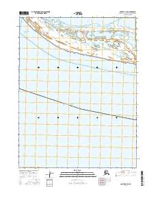
2016 Map of Noatak A-4 SE
USGS Topo · Published 2016About this map
Cape Krusenstern National Monument occupies the northeastern corner of this coastal survey, where the waters of the Chukchi Sea meet the Arctic coastline. The landscape is defined by the expansive Krusenstern Lagoon, a significant coastal feature separated from the sea by a series of narrow beach ridges. These ridges are of particular interest as they record thousands of years of human habitation and environmental change in the Arctic, though they are presented here as topographical elements within the monument's protected boundaries.
Find a feature on this map
7 named features on this map. Tap any name to fly to it.
Don’t see what you’re looking for? This feature index may not catch every label — zoom into the map to look around manually.
Map Details
Editions of this 2016 Noatak A-4 SE Map
This is the sole edition of this map. No revisions or reprints were ever made.
Other maps of this area

1951 · Noatak
USGS Topo · 1:250,000

1951 · Kotzebue
USGS Topo · 1:250,000

1952 · Noatak A-3
USGS Topo · 1:63,360
1952 · Noatak A-4
USGS Topo · 1:63,360

1955 · Noatak
USGS Topo · 1:250,000

1958 · Kotzebue
USGS Topo · 1:250,000

1964 · Noatak
USGS Topo · 1:250,000

1964 · Kotzebue
USGS Topo · 1:250,000
2014 · Noatak A-4 NW
USGS Topo · 1:25,000
2015 · Noatak A-3 NW
USGS Topo · 1:25,000