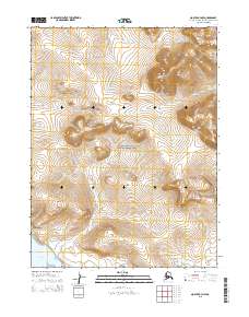
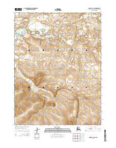
2015 Map of Noatak A-3 NW
USGS Topo · Published 2015About this map
Cape Krusenstern National Monument dominates this coastal landscape in the Northwest Arctic Borough, where the terrain transitions from the Chukchi Sea shoreline to the interior heights. The map tracks the complex hydrology of the region, from the tidal waters of Krusenstern Lagoon and Kasik Lagoon to the inland winding courses of the Evelukpalik River and Situkuyok River. Moving east from the low-lying lagoons, the topography rises sharply into a series of named peaks and ridges, including Tiyaktalik Mtn, Milokraulok Mtn, and the Kislowrut Hills. This 2015 survey illustrates how the northern drainage systems like Milokraulok Cr carve through the upland summits of Akargichek Mtn and Simik Mtn, providing a detailed look at the geographic character of this protected Alaskan wilderness.
Find a feature on this map
17 named features on this map. Tap any name to fly to it.
Don’t see what you’re looking for? This feature index may not catch every label — zoom into the map to look around manually.
Map Details
Editions of this 2015 Noatak A-3 NW Map
This is the sole edition of this map. No revisions or reprints were ever made.
Other maps of this area

1951 · Noatak
USGS Topo · 1:250,000

1952 · Noatak A-3
USGS Topo · 1:63,360
1952 · Noatak A-4
USGS Topo · 1:63,360

1955 · Noatak
USGS Topo · 1:250,000

1955 · Noatak B-3
USGS Topo · 1:63,360

1955 · Noatak B-4
USGS Topo · 1:63,360

1964 · Noatak
USGS Topo · 1:250,000
2014 · Noatak B-4 SE
USGS Topo · 1:25,000
2015 · Noatak A-3 NE
USGS Topo · 1:25,000
2015 · Noatak B-3 SW
USGS Topo · 1:25,000