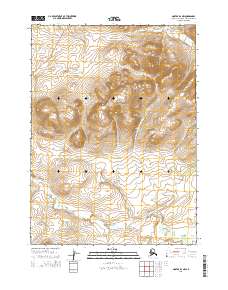
2015 Map of Noatak D-2 NW
USGS Topo · Published 2015About this map
Sivukat Mtn dominates the central landscape of this Northwest Arctic territory, rising above a network of drainages that feed into Evaingiknuk Cr. The map illustrates a transitional landscape where industrial infrastructure meets the high tundra, most notably marked by the Red Dog Mine Road cutting across the northwest corner. This vital transportation corridor serves one of the world's most significant zinc and lead operations, providing a rare human imprint on a terrain otherwise defined by high elevations and seasonal waterways. The survey reveals the complex drainage patterns of the region, showing how smaller tributaries converge at the base of the mountain range to form the wider reach of the creek as it flows south toward the Noatak River valley.
Find a feature on this map
7 named features on this map. Tap any name to fly to it.
Don’t see what you’re looking for? This feature index may not catch every label — zoom into the map to look around manually.
Map Details
Editions of this 2015 Noatak D-2 NW Map
This is the sole edition of this map. No revisions or reprints were ever made.
Other maps of this area

1951 · De Long Mountains
USGS Topo · 1:250,000

1951 · Noatak
USGS Topo · 1:250,000

1955 · Noatak
USGS Topo · 1:250,000

1955 · De Long Mountains
USGS Topo · 1:250,000

1955 · Noatak D-3
USGS Topo · 1:63,360

1955 · Noatak D-2
USGS Topo · 1:63,360

1955 · De Long Mountains A-2
USGS Topo · 1:63,360

1964 · Noatak
USGS Topo · 1:250,000

1965 · De Long Mountains
USGS Topo · 1:250,000
2014 · Noatak D-3 SE
USGS Topo · 1:25,000