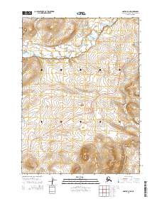
2015 Map of Noatak D-3 NE
USGS Topo · Published 2015About this map
Red Dog Mine Road cuts a distinct path through this northern interior landscape, serving as a primary corridor for industrial transport within the Northwest Arctic region. This 2015 survey illustrates the isolation and scale of the terrain, where watercourses like Ikalukrok Cr and Evaingiknuk Cr define the natural drainage patterns across the survey blocks of t30n r20w and t29n r19w. The map provides a clear look at the infrastructure required to support mining operations in this environment, showing the road as it follows the topography and crosses several minor tributaries. For researchers and surveyors, the document accurately positions the public land survey system lines against the winding path of the creeks and the heavy-duty haul road that connects this remote area to the broader regional network.
Find a feature on this map
7 named features on this map. Tap any name to fly to it.
Don’t see what you’re looking for? This feature index may not catch every label — zoom into the map to look around manually.
Map Details
Editions of this 2015 Noatak D-3 NE Map
This is the sole edition of this map. No revisions or reprints were ever made.
Other maps of this area

1951 · De Long Mountains
USGS Topo · 1:250,000

1951 · Noatak
USGS Topo · 1:250,000

1955 · Noatak
USGS Topo · 1:250,000

1955 · De Long Mountains
USGS Topo · 1:250,000

1955 · Noatak D-3
USGS Topo · 1:63,360

1955 · Noatak D-2
USGS Topo · 1:63,360

1955 · De Long Mountains A-3
USGS Topo · 1:63,360

1955 · De Long Mountains A-2
USGS Topo · 1:63,360

1964 · Noatak
USGS Topo · 1:250,000

1965 · De Long Mountains
USGS Topo · 1:250,000