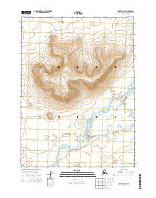
2014 Map of Noatak D-4 NE
USGS Topo · Published 2014About this map
Iyikrok Mountain dominates the northern landscape of this Arctic region, where dramatic elevation changes define the transition from high peaks to the braided river valleys below. To the south, the Wulik River winds through the terrain, joined by the waters of Ikalukrok Cr as they move across a plain marked by distinctive landforms like Imnak Bluff and Sivugak Hill. This 2014 survey captures a remote wilderness within the Northwest Arctic Borough, documenting the intricate drainage patterns where Tutak Cr and other small tributaries meet the larger river systems. The map provides a detailed record of the physical geography of the Noatak area, showing how these waterways have carved through the landscape at the base of Ponrakvirak Hill.
Find a feature on this map
11 named features on this map. Tap any name to fly to it.
Don’t see what you’re looking for? This feature index may not catch every label — zoom into the map to look around manually.
Map Details
Editions of this 2014 Noatak D-4 NE Map
This is the sole edition of this map. No revisions or reprints were ever made.
Other maps of this area

1951 · De Long Mountains
USGS Topo · 1:250,000

1951 · Noatak
USGS Topo · 1:250,000

1955 · Noatak
USGS Topo · 1:250,000

1955 · De Long Mountains
USGS Topo · 1:250,000

1955 · Noatak D-4
USGS Topo · 1:63,360

1955 · Noatak D-3
USGS Topo · 1:63,360

1955 · De Long Mountains A-3
USGS Topo · 1:63,360

1964 · Noatak
USGS Topo · 1:250,000

1965 · De Long Mountains
USGS Topo · 1:250,000
2014 · Noatak D-4 SE
USGS Topo · 1:25,000