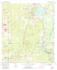
1954 Map of Nobleton
USGS Topo · Published 1988About this map
The Withlacoochee River carves a winding path along the eastern border of this mid-century Florida landscape, defining the boundaries between Citrus, Sumter, and Hernando counties. The era’s extractive industrial footprint is clearly visible through a dense concentration of phosphate and limestone operations, including Story Mine, Sixteen Mine, and the Ten Cent Mine. These mining sites, alongside numerous scattered quarries, suggest a landscape defined as much by its subterranean resources as its surface hydrology.
Find a feature on this map
36 named features on this map. Tap any name to fly to it.
Don’t see what you’re looking for? This feature index may not catch every label — zoom into the map to look around manually.
Map Details
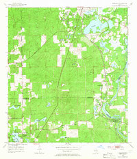
Editions of this 1954 Nobleton Map
3 editions found
Other maps of this area

1893 · Panasoffkee
USGS Topo · 1:62,500

1895 · Tsala Apopka
USGS Topo · 1:62,500

1895 · Panasoffkee
USGS Topo · 1:62,500

1954 · Lecanto
USGS Topo · 1:24,000

1954 · Brooksville NW
USGS Topo · 1:24,000

1954 · Nobleton
USGS Topo · 1:24,000

1954 · Brooksville
USGS Topo · 1:24,000

1954 · Inverness
USGS Topo · 1:24,000

1954 · Brooksville SE
USGS Topo · 1:24,000

1954 · Inverness
USGS Topo · 1:62,500