
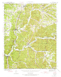
1940 Map of Noel
USGS Topo · Published 1955About this map
Noel and the surrounding southwest Missouri landscape are defined by the winding course of the Elk River and Sugar Creek just before the Second World War. The region shows a distinct pattern of valley floor settlements and high-ridge homesteads, connected by the Kansas City Southern railroad and Highway 71. The map documents a rural society served by numerous small schoolhouses like Puckett Sch and Banner Sch, alongside community anchors such as Christian Ch and Mt Zion Ch.
Find a feature on this map
90 named features on this map. Tap any name to fly to it.
Don’t see what you’re looking for? This feature index may not catch every label — zoom into the map to look around manually.
Map Details
Editions of this 1940 Noel Map
2 editions found
Other maps of this area

1899 · Fayetteville
USGS Topo · 1:125,000

1899 · Siloam Springs
USGS Topo · 1:125,000

1901 · Fayetteville
USGS Topo · 1:125,000

1903 · Siloam Springs
USGS Topo · 1:125,000

1904 · Siloam Springs
USGS Topo · 1:125,000

1904 · Fayetteville
USGS Topo · 1:125,000

1907 · Wyandotte
USGS Topo · 1:125,000

1909 · Wyandotte
USGS Topo · 1:125,000

1916 · Neosho
USGS Topo · 1:62,500

1941 · Rocky Comfort
USGS Topo · 1:62,500