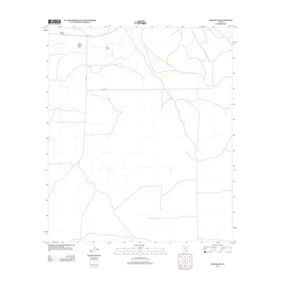
2012 Map of Noelke SW
USGS Topo · Published 2012About this map
The arid ranchlands of Crockett County are defined by a network of ephemeral drainage patterns and isolated county roads. This landscape is shaped by long-term water management and livestock patterns, where terrain features like Wilson Draw and the curiously named Dutch Woman Draw dictate the movement of both animals and equipment. In this region, seasonal water sources like Spring Cr are essential landmarks, punctuating the dry draws that cut through the high plains. The transition of the local infrastructure is evident in the rectilinear grid of University Ln and the simple, functional routes of Co Rd 131 and Co Rd 132, which provide the primary access to these sprawling West Texas properties. The map reveals the quiet, persistent nature of Texas ranching life, where the names of these dry washes remain the most significant identifiers on the land.
Find a feature on this map
7 named features on this map. Tap any name to fly to it.
Don’t see what you’re looking for? This feature index may not catch every label — zoom into the map to look around manually.
Map Details
Editions of this 2012 Noelke SW Map
This is the sole edition of this map. No revisions or reprints were ever made.
Other maps of this area
1895 · Sherwood
USGS Topo · 1:125,000
1920 · Barnhart
USGS Topo · 1:62,500

1922 · Barnhart
USGS Topo · 1:62,500

1954 · Sonora
USGS Topo · 1:250,000

1954 · San Angelo
USGS Topo · 1:250,000

1958 · Sonora
USGS Topo · 1:250,000
1958 · San Angelo
USGS Topo · 1:250,000
1964 · Oglesby Ranch
USGS Topo · 1:24,000
1964 · Moore Ranch
USGS Topo · 1:24,000
1965 · San Angelo
USGS Topo · 1:250,000