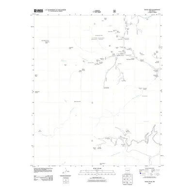
2011 Map of Nogal Peak
USGS Topo · Published 2011About this map
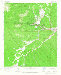
Nogal Peak and the high ridges of the Sacramento Mountains dominate this landscape, which is defined by a dense history of resource extraction and alpine recreation. The mining legacy of the Lincoln National Forest is evident in the cluster of claims and shafts along the eastern canyons, including the Parsons Mine, Stonewall Jackson Mine, and the Silver King Tunnel. These sites trace the early 20th-century prospecting era when settlements like Greenville served as local hubs. In the southern portion of the quadrangle, the focus shifts to modern usage at the Sierra Blanca Ski Area and Sierra Blanca Lodge, located near Sierra Blanca Peak. The intricate drainage patterns of South Fork Rio Bonito and Three Rivers carve through the terrain, connecting high-altitude springs like Skull Canyon Spring to the valleys below.
Find a feature on this map
94 named features on this map. Tap any name to fly to it.
Don’t see what you’re looking for? This feature index may not catch every label — zoom into the map to look around manually.
Map Details
Editions of this 2011 Nogal Peak Map
This is the sole edition of this map. No revisions or reprints were ever made.
Other maps of this area
1934 · Capitan
USGS Topo · 1:48,000
1937 · Capitan
USGS Topo · 1:62,500
1938 · Carrizozo
USGS Topo · 1:48,000
1943 · Carrizozo
USGS Topo · 1:62,500
1950 · Carrizozo
USGS Topo · 1:62,500
1950 · Sierra Blanca Peak
USGS Topo · 1:62,500

1955 · Roswell
USGS Topo · 1:250,000

1958 · Roswell
USGS Topo · 1:250,000
1962 · Roswell
USGS Topo · 1:250,000
1963 · Ruidoso
USGS Topo · 1:24,000