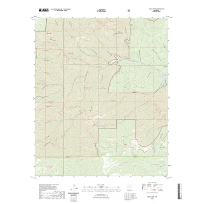
2023 Map of Nogal Peak
USGS Topo · Published 2023About this map
White Mountain Wilderness and Lincoln National Forest dominate this high-altitude landscape in New Mexico, where the terrain is defined by dramatic elevations reaching to Lookout Mountain and Argentina Peak. The map documents a complex network of seasonal water sources and springs vital to this arid environment, including Turkey Spring, Devil Spring, and the unique Blue Hole Pond. A sophisticated system of backcountry trails, such as the Crest Trl and Doherty Ridge Trl, connects various canyons and ridges, illustrating the recreational and conservation management of the region. Notable landmarks like White Horse Hill and the headwaters of the South Fork Rio Bonito provide specific points of interest for navigating the deep drainages of Tanner Canyon and Rattlesnake Canyon near the boundary of Lincoln Co and Otero Co.
Find a feature on this map
96 named features on this map. Tap any name to fly to it.
Don’t see what you’re looking for? This feature index may not catch every label — zoom into the map to look around manually.
Map Details
Editions of this 2023 Nogal Peak Map
This is the sole edition of this map. No revisions or reprints were ever made.
Other maps of this area

1934 · Capitan
USGS Topo · 1:48,000

1937 · Capitan
USGS Topo · 1:62,500

1938 · Carrizozo
USGS Topo · 1:48,000

1943 · Carrizozo
USGS Topo · 1:62,500

1950 · Carrizozo
USGS Topo · 1:62,500

1950 · Sierra Blanca Peak
USGS Topo · 1:62,500

1955 · Roswell
USGS Topo · 1:250,000

1958 · Roswell
USGS Topo · 1:250,000

1962 · Roswell
USGS Topo · 1:250,000

1963 · Ruidoso
USGS Topo · 1:24,000