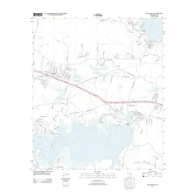
2013 Map of Nolanville
USGS Topo · Published 2013About this map
Nolanville sits at the center of a landscape defined by significant water management projects in Bell County. This survey illustrates the proximity of the community to major reservoirs, including Belton Lake to the north and the expansive Stillhouse Hollow Lake to the south. The terrain between these waters is marked by a network of drainage features like N Nolan Cr and S Nolan Cr, alongside numerous soil conservation reservoirs. For local historians, the map preserves the location of several burial grounds, including Burris Cem, McDowell Cem, and Proctor Cem, which provide a grounded link to the area's early families. Notable landmarks such as The Narrows, Dana Peak, and Chalk Ridge Falls along the Lampasas River highlight the distinct topography that persists despite modern development and highway infrastructure like W Hwy 190.
Find a feature on this map
162 named features on this map. Tap any name to fly to it.
Don’t see what you’re looking for? This feature index may not catch every label — zoom into the map to look around manually.
Map Details
Editions of this 2013 Nolanville Map
This is the sole edition of this map. No revisions or reprints were ever made.
Other maps of this area

1885 · Taylor
USGS Topo · 1:125,000

1887 · Taylor
USGS Topo · 1:125,000

1892 · Temple
USGS Topo · 1:125,000

1893 · Georgetown
USGS Topo · 1:125,000

1894 · Gatesville
USGS Topo · 1:125,000

1894 · Taylor
USGS Topo · 1:125,000

1924 · Gatesville 4-d
USGS Topo · 1:48,000

1924 · Gatesville 4-a
USGS Topo · 1:48,000

1924 · Temple 3-C
USGS Topo · 1:48,000

1924 · Temple 3-B
USGS Topo · 1:48,000