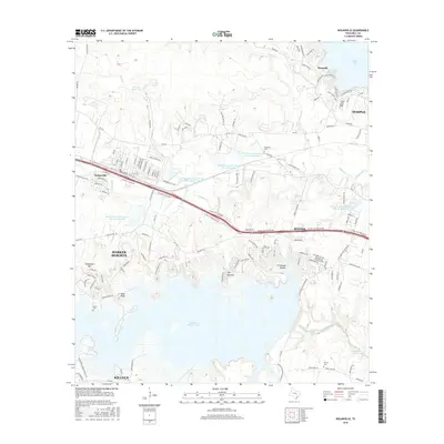
2016 Map of Nolanville
USGS Topo · Published 2016About this map
Nolanville and the eastern fringes of Killeen anchor the western portion of this 2016 Texas landscape, where suburban growth meets the waters of Stillhouse Hollow Lake. The terrain is defined by dramatic limestone features such as Comanche Gap and The Narrows, which overlook the winding course of the Lampasas River. These natural landmarks provided early navigation points and still shape the modern layout of Harker Heights. To the north, Belton Lake edges into the frame near the community of Westcliff.
Find a feature on this map
146 named features on this map. Tap any name to fly to it.
Don’t see what you’re looking for? This feature index may not catch every label — zoom into the map to look around manually.
Map Details
Editions of this 2016 Nolanville Map
This is the sole edition of this map. No revisions or reprints were ever made.
Other maps of this area

1885 · Taylor
USGS Topo · 1:125,000

1887 · Taylor
USGS Topo · 1:125,000

1892 · Temple
USGS Topo · 1:125,000

1893 · Georgetown
USGS Topo · 1:125,000

1894 · Gatesville
USGS Topo · 1:125,000

1894 · Taylor
USGS Topo · 1:125,000

1924 · Gatesville 4-d
USGS Topo · 1:48,000

1924 · Gatesville 4-a
USGS Topo · 1:48,000

1924 · Temple 3-C
USGS Topo · 1:48,000

1924 · Temple 3-B
USGS Topo · 1:48,000