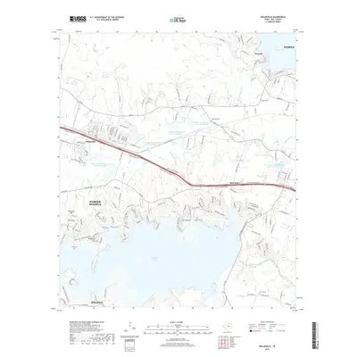
2019 Map of Nolanville
USGS Topo · Published 2019About this map
Stillhouse Hollow Lake dominates this Central Texas landscape, with its northern arms reaching into a terrain defined by suburban expansion and managed water resources. The shoreline is punctuated by prominent elevations such as Dana Peak, Twin Peaks, and Goats Bluff, while the southern end of the reservoir meets the Lampasas River near Chalk Ridge Falls. A series of Soil Conservation Service reservoirs, including Site 12 Reservoir, indicate a highly managed watershed that serves the growing corridor between Killeen and Temple.
Find a feature on this map
171 named features on this map. Tap any name to fly to it.
Don’t see what you’re looking for? This feature index may not catch every label — zoom into the map to look around manually.
Map Details
Editions of this 2019 Nolanville Map
This is the sole edition of this map. No revisions or reprints were ever made.
Other maps of this area

1885 · Taylor
USGS Topo · 1:125,000

1887 · Taylor
USGS Topo · 1:125,000

1892 · Temple
USGS Topo · 1:125,000

1893 · Georgetown
USGS Topo · 1:125,000

1894 · Gatesville
USGS Topo · 1:125,000

1894 · Taylor
USGS Topo · 1:125,000

1924 · Gatesville 4-d
USGS Topo · 1:48,000

1924 · Gatesville 4-a
USGS Topo · 1:48,000

1924 · Temple 3-C
USGS Topo · 1:48,000

1924 · Temple 3-B
USGS Topo · 1:48,000